Rhode Island census tract map by county
$ 31.50
In Stock - Shipping time: In Stock 2 weeks (aprox.)
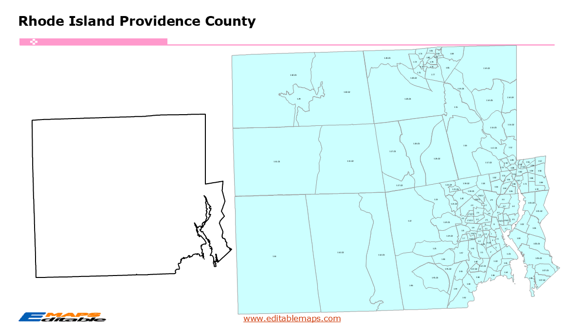
The Rhode Island census tract map by county templates in PowerPoint format includes 7 slides. Firstly, it is a blank US State map template. Secondly the Rhode Island map with 5 counties. Thirdly regarding the 247 census tracts, the Rhode Island census tract map by county product has grouped them by 5 counties, as PowerPoint templates are labeled with Census Tracts’ codes. The layers are grouped into two categories, one by Census Tracts shapes and the other by Census Tracts’ names, which makes it easier to customize your slides.The U.S. state of Rhode Island is divided into 5 counties, then further divided into 247 county Census Tracts. It is based on the latest 2020 Census Bureau TIGER/Line data.The 7 slides are listed below.US state map and Rhode Island Map of outline (1)Rhode Island Map with 5 Counties (1)Rhode Island census tract map by county, Each County with its Census Tracts and codes labeled (5)The 5 counties and the number of their Census Tracts are as follows. Bristol County (11), Kent County (39), Newport County (23), Providence County (145), and Washington County (29).Rhode Island is a state in the New England region of the Northeastern US. It borders Massachusetts to its north and east, and Connecticut to its west. To its south, the state meets the Atlantic Ocean through the vast waters of Narragansett Bay and the Rhode Island Sound. Providence is the capital of this State.About this Product: Rhode Island Census Tract Master BundleSince Rhode Island is the smallest state, a tract-level bundle is particularly useful for urban planners and business analysts who need to see “the big picture” in a compact area.“About this Product: Rhode Island Census Tract Map Bundle (The Ocean State Edition)”Maximize your analysis of the nation’s smallest state with this Rhode Island Census Tract Map Bundle. Despite its size, Rhode Island is one of the most densely populated states, making neighborhood-level tract data essential for accurate market research and policy planning.Why this bundle is essential:Complete 5-County Coverage: Individual, high-detail slides for Providence, Kent, Washington, Newport, and Bristol counties.Native PowerPoint Shapes: Every tract is an editable vector. Click and fill to color-code the high-density blocks of Providence or the coastal communities of South County.Narragansett Bay Precision: Meticulously drawn shorelines ensure your maps look professional and geographically accurate for coastal analysis.Plug-and-Play Design: Perfect for highlighting Opportunity Zones in Pawtucket or conducting CRA (Community Reinvestment Act) compliance reviews in the East Bay.If you want to get free US maps, please visit our affiliate’s website yourfreetemplates.com