Maine census tract map by county
$ 45.00
In Stock - Shipping time: In Stock 2 weeks (aprox.)
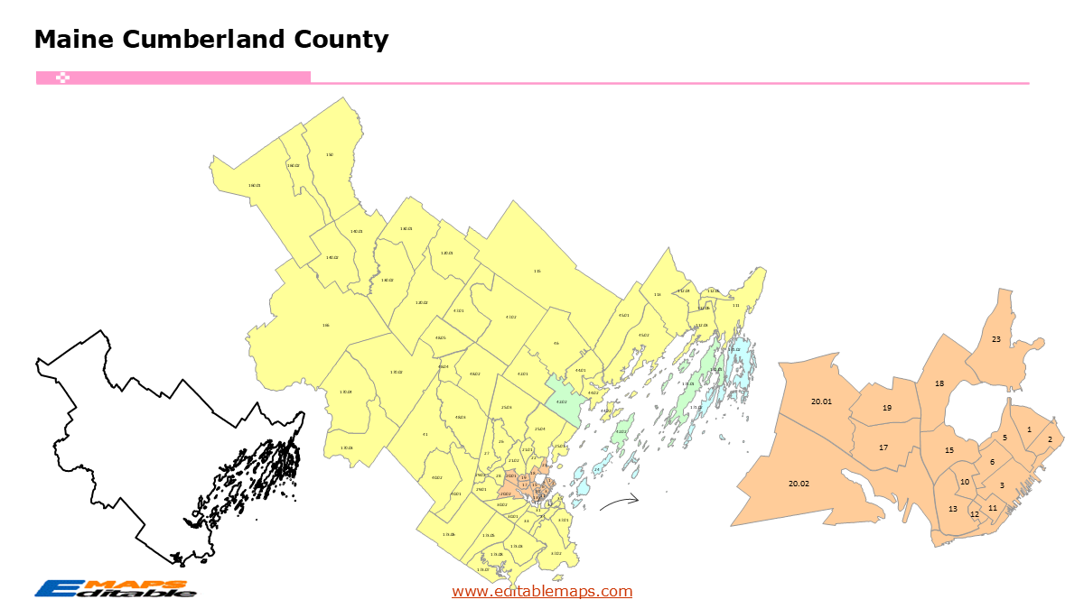
The Maine census tract map by county templates in PowerPoint format includes 18 slides. Firstly, it is a blank US State map template. Secondly the Maine map with 16 counties. Thirdly regarding the 402 census tracts, the Maine census tract map by county product has grouped them by 16 counties, as PowerPoint templates are labeled with Census Tracts’ codes. The layers are grouped into two categories, one by Census Tracts shapes and the other by Census Tracts’ names, which makes it easier to customize your slides.The U.S. state of Maine is divided into 16 counties, then further divided into 402 county Census Tracts. It is based on the latest 2020 Census Bureau TIGER/Line data.The 18 slides are listed below.US state map and Maine Map of outline (1)Maine Map with 16 Counties (1)Maine census tract map by county, Each County with its Census Tracts and names labeled (16)The 16 counties and the number of their Census Tracts are as follows. Androscoggin County (32), Aroostook County (24), Cumberland County (80), Franklin County (10), Hancock County (17), Kennebec County (36), Knox County (12), Lincoln County (9), Oxford County (19), Penobscot County (46), Piscataquis County (8), Sagadahoc County (8), Somerset County (20), Waldo County (8), Washington County (14), and York County (59).Maine is a state in the New England region of the Northeastern US. It is unique as the only state to border exactly one other US state, New Hampshire, to its west. To its northwest and northeast, it borders the Canadian provinces of Quebec and New Brunswick. To its south and east, Maine meets the Atlantic Ocean along a world-famous, ruggedly rocky coastline. Augusta is the capital of this State.About this Product: Maine Census Tract Master BundleThis bundle is particularly valuable because it handles the complexity of Maine’s Unorganized Territories (UTs), which occupy much of the northern half of the state and are often difficult to map accurately in PowerPoint.As of the 2020 Census, the state of Maine is divided into exactly 402 census tracts. This is an increase from the 358 tracts defined during the 2010 Census, reflecting the state’s shifting population density and the U.S. Census Bureau’s effort to keep tract populations within the target range of 1,200 to 8,000 people.These 402 tracts serve as the primary “building blocks” for demographic analysis, urban planning, and the allocation of federal resources across Maine’s 16 counties.Geographic & Demographic HighlightsThe Urban Divide: Most of Maine’s 402 tracts are concentrated in the southern and coastal “I-95 corridor.” In cities like Portland, South Portland, and Lewiston, tracts are small and densely packed, allowing for high-resolution data on housing, income, and diversity.The North Woods (The UTs): In northern counties like Aroostook, Somerset, and Piscataquis, a single census tract may encompass multiple “townships” or unorganized territories. These are some of the largest tracts in the Eastern United States by land area.Population Splits: The jump to 402 tracts occurred because growing communities—particularly in York and Cumberland counties—saw their 2010 tracts exceed the 8,000-person limit. To maintain data accuracy, the Census Bureau “split” these into two or more smaller tracts for 2020.“About this Product: Maine Census Tract Map Bundle (Vacationland Edition)”Explore the “Pine Tree State” in unmatched detail with this complete Maine Census Tract Map Bundle for PowerPoint. Covering all 16 counties, this toolkit is optimized for professionals who need to visualize data in both Maine’s dense urban centers and its vast rural landscapes.Why this bundle is essential:16 County Slides Unorganized Territories: Includes individual slides for every county, with special attention to the large Unorganized Territory (UT) census tracts in Aroostook, Piscataquis, and Somerset counties.100% Editable Vector Shapes: Every census tract is a native PowerPoint shape.2020 Census Standards: Built using the latest TIGER/Line data to ensure precise boundaries for every neighborhood and rural township.Optimized for Impact: Perfect for presenting broadband expansion plans, Real Estate Opportunity Zones, or public health outreach across Maine’s unique geography.“Down East” Accuracy: Meticulously drawn coastal boundaries that respect Maine’s complex “jagged” shoreline for professional-grade visual quality.If you want to get free US maps, please visit our affiliate’s website yourfreetemplates.com